![]()
• Bird Watching
• Scuba Diving
• Hiking
• Surfing
• Febrina
• Oceania
• True North
Southern Highlands Province
• Ambua Lodge
East Sepik Province
• Karawari Lodge
North Coast, Madang
• Malolo Plantation Lodge
Sepik and Karawari Rivers
• MV Sepik Spirit
Tonda Wildlife Management Area, Western Province
• Bensbach Wilderness Lodge
Western Highlands Province
• Rondon Ridge
Western Province
• Lake Murray Lodge
• A Highlands Adventure, 5 Days
• Birding in Paradise, 12 Days
• New Guinea Encounter, 8 Days
• New Guinea Village Experience, 8 Days
PNG Pre & Post Diving Tours
• Central Highlands Trekking: Kerowagi to Gembogl: 4 days/3 nights tour
• Climbing Mt Whilem 4509m - PNG Highest Peak: 4 days/3 nights
• Sepik River Motorised Canoe Safari Cruise: 5 Days/4 nights
• Trekking in Tari- Home of the Huli Wigmen: 4 Days/3 nights
• PNG Highlands West Expedition
• PNG Highlands North Expedition
• History of Bingla Ingu Festival
PNG Cultural Events
June
• Madang Festival
July
• Mask Festival
August
• Crocodile Festival
• Enga Show
• Hagen Show
• Paiya Mini Show
September
• Goroka Show
• Kalam Festival
• Kutubu Kundu Digaso
November
• Kenu & Kundu Festival
Africa
• Djibouti
• Madagascar
• Malawi
• Mozambique
• São Tomé and Príncipe
• South Africa
• St Helena Island
• Tanzania
Atlantic Ocean
• Portugal
Caribbean
• Costa Rica
• Cuba
• Dominica
• Dominican Republic
Central & Western Pacific
• Australia
• Fiji
• French Polynesia - Tahiti
• Micronesia
• Papua New Guinea
• Philippines
• Solomons
• Tonga
• Vanuatu
Eastern Pacific
• Cocos Islands
• Galapagos
• Guadalupe
• Malpelo Island
• Mexico
• Socorro
Indian Ocean
• Indonesia
• Malaysia
• Maldives
• Seychelles
• Alphonse Island
• Sri Lanka
• Thailand
• Timor-Leste
Others
• Arctic & Antarctica
• Red Sea - Egypt - Sudan
Sharks, Whales, etc
• Sardine Run
• Shark Diving
• Mozambique
• South Africa
• South Australia
• Farallon Islands, USA
• Guadalupe, Mexico
• Whale Watching
Africa
• Active Africa
• Ethiopia
• Morocco
Asia
• India
• Myanmar in Focus
South America
• Argentina
• Brazil
• Chile
• Ecuador
• Guyana & Suriname
• Peru
Others
• Italy
• New Zealand

Home > Diving PNG > PNG Land Tours
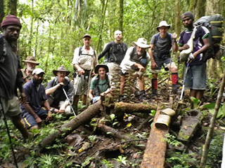
Shaggy Ridge Battlefield Trek, 9 Days
We invite you to walk with us along this 97 klm most beautiful rugged track, let us share with you the emotional stories of our brave young diggers. Get to meet all our kind, generous Papua New Guinean friends who live along the trail and have an adventure of a life time. It is important to PNG Trekking that our trekkers not only get to experience the W11 History along our PNG tracks but to also immerse themselves in the culture. This trek is designed to combine both experiences. It is important that all the people from Dumpu through to Madang benefit from eco-tourism. This is why we choose to take this route. We feel that trekkers that come to Papua New Guinea need to understand the culture thus in turn understanding the climate that our soldiers were fighting in.
The World Warll History: The 1942-43 defeats of the Japanese at, Kokoda, Milne Bay, around Buna and at Wau opened the way for the Allies to plan and mount the advance on the major objective of Lae, New Guinea. This large Japanese base sat on the coast near the mouth of the Markham River at the southern end of the Huon Peninsula. By capturing this area, the Allies would be able to develop airfields in the Markham Valley to support subsequent advances along the north coast. In May 1943, General Douglas MacArthur, Commander-in-Chief of the Allied forces in the South-West Pacific Area, issued a directive for the attack on Lae. Australian forces were to capture Lae, and then continue with two advances at the same time, one around the coast of the Huon Peninsula and the other inland following the Markham and Ramu Valleys. The latter would culminate with the capture of one of the key features, Shaggy Ridge. Walk the track and learn more.
The Shaggy Ridge trek is raw and out there, is also logistically a very difficult expedition to facilitate.
There has been a number of inquiries over the past several years, many from descendants of soldiers that fought along this track. They are wanting to walk in the footsteps of their loved ones and learn more about this campaign.
We need 8 or more trekkers before we are able to proceed with this trek.

COST: Please send a request for rates
Included- 1 nights' accommodation Lae – Breakfast (Based on twin share)
- 1 night's accommodation Madang – Breakfast (Based on twin share)
- Domestic Airfares. POM-LAE
- Domestic Airfares MADANG-POM
- Airport Transfers-POM-Nadzab
- Services of an Australian Tour Leader (Chris Stevens)
- Road transfers from Lae to Dumpu (start of track)
- PNG Carriers for food and equipment
- Road transfers end of trek to Madang
- 7 nights' accommodation on Track
- Gear not required on track transferred by road Lae-Madang
- Tents (each trekker gets a two person tent, if trekkers want to share then we allocate 3 person tents
- Airport Transfers Madang
- Shaggy Ridge Track Authority Trek Permit
- Village Fees
- Polo Shirt and Shaggy Ridge Certificate
- Public Liability Insurance
- Licensed PNG Tour Operator
- Satellite Phones
- Medivac Procedures
Not Included
- International Airfares
- The cost of a personal porter is A$790.00 which covers the porter's wages, food, relocation back to village and road transport.
- Passport & Visa Costs
- Travel Insurance
- Vaccinations and anti-malaria medicines
- Port Moresby/Lae accommodation Single Supplement A$198.00
Itinerary
Day 1: Arrive Port Moresby
On arrival at Port Moresby International Airport trekkers will be met by PNG Trekking Adventures representatives and transferred to the domestic terminal to book onto domestic flights. We will then take trekkers to the PNG Trekking offices where a equipment check and briefing of what will be happening over the next 8 days. On arrival at Nadzab airport transfer to Lae Hotel taking approximately 45 minutes. Hotel Accommodation.
Day 2: Lae, Dumpu to Agana Village Camp
Following breakfast a 4 hr drive from Lae to Dumpu, stopping at Kaipit (2 hrs drive from Lae) were the significant bloody battle of the 2/6th Independent Company took place 16 Sept 1943, this area was one of two airfields General MacArthur instructed General Blamey to establish. The other airfield being Dumpu. The battle of Shaggy Ridge was to protect the 185 Kilometre long stretch grassy corridor well suited to airfields, establishment and protection of which were crucial in this campaign. Shaggy Ridge was the higher ground, falling to the Northt foot of Shaggy Ridge was the Japanese lifeline, the Japanese had established a supply route, a well engineered road from the North, Bogadjim/Madang to Lae, Shaggy Ridge towered over this lifeline.
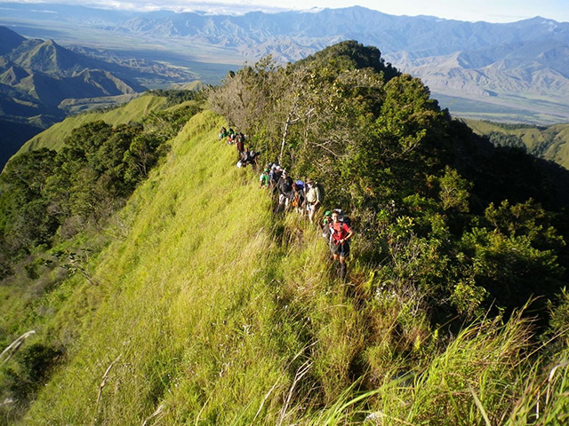
From Onga Village/Road where our road transport meets up with our porters, our trek begins, A steady incline in Short grass, entwining along the lower ridges towards a saddle, there is no canopy, sun can be very hot and taxing, Stunning views of Ramu Village, slight descent into Agana Village. The village is located at the foothills of Shaggy Ridge, South of Guys Post. Wash area is a 5-7 min walk to a piped creek. Camp is in the village, were we will set up our tents and become familiar with equipment and procedures and locals, most of our porters are from Agana/Dumpu Village. Camp 350 meters, Trek distance 6.5km, 2.5 hours walk. Bush Camp (Meals: BLD)
Day 3: Agana Village to The Army Oven/Japanese Wire Camp
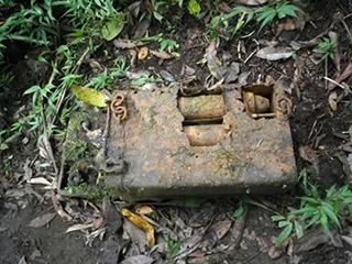
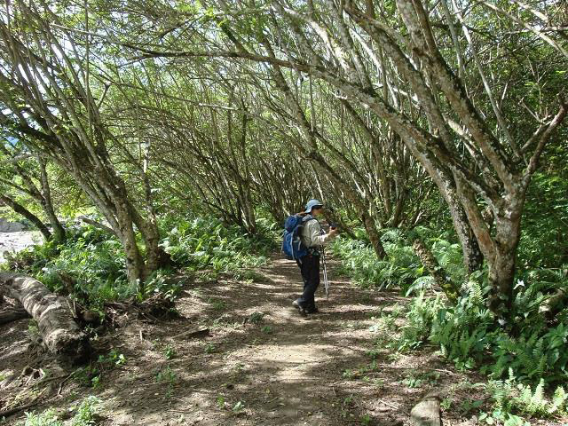
This morning we enter the rain forest , we are on a ridge spur, covered by trees and vegetation, which takes about two and a half hours to climb - with sensible rest breaks. Weapon pits from the fighting 60 plus years ago are evident from time to time along the way. Just prior to the high point at the end of the climbing, weapon pits become more frequent and the site of a field cook house (complete with improvised "drum oven") marks the last five minutes of the day's trekking. Two minutes incline past this site, marks the Japanese Wired Tree site. Camp is situated on the South Western side of Shaggy Ridge summit, the first "Pimple" feature along Shaggy Ridge proper, amongst numerous weapon pits, Australian and Japanese - with some of the Japanese pits interconnected by now collapsed tunnel systems. The shape of the ground now narrows to a razor back ridge, which commences here, and runs northerly for the next full day's walking.
The Bush camp is made amongst the weapon pits, utilising small level areas cut into the side of the steep slopes by the soldiers. We will erect our tents at this site. We must conserve our water to make certain we have adequate for our personal and camp needs tonight and tomorrow. This camp can be cold, with an added chill from the wind, and on some occasions, wind driven rain. Another challenge for the staff to prepare a hot meal and drinks for trekkers. Camp 1400 meters (South Western end of Shaggy Ridge). Trek Distance 5.5km, 6 hours walk through/ steep terrain. Bush Camp (Meals: BLD)
Day 4: Army Oven/ Japanese Wire Camp to Kankiryo Saddle, Mindjim River Camp
Today up early and the description "contouring" does not fairly describe the labour involved in making progress along sections of today's walk, although the tracks we follow does often parallel the crest line. The paths are not used by locals, and visitors are very rare, hence some use of the bush knives and axes will be required to re open the pathways. All along the ridge line, weapon pits can be seen, most identifiable as connected with specific extreme endeavors’ of close quarter battle. Relics are evident in the battle areas. The views from the crest are magnificent, and it is easy to see why the Japanese situated themselves so firmly there and why the Australians had to get them off it to protect their supply and communication lines so vital to the Allied advance.
Clouds will, from time to time, swirl in with the wind, and blot out everything, even percolating down into the closely vegetated path on the protected side. Old small observation post holes along the crest add to the need for care. These are now overgrown and hidden so the carriers take care to point them out. The day's actual progress means a degree of flexibility enters into the schedule for the overnight stop. There are three alternative sites; one on the Northern end of Shaggy Ridge high ground, the other two at the foot of the ridge, first site at foot of hill is Kankiryo Saddle- about 1 1/2 hours further on from the high camp. Descent is steep, slippery and through thick vegetation, with options to climb surrounding hills were significant battles took place. Our second site is along the side of Mindjim River another 60 minutes walk along flat ground. Each area is also a war time camp with relics around either of these sites. Trek Distance 14km, 7 hrs, difficult flat walking, steep descent, finishing off with flat walking, lots of breaks recommended. 2½ spent looking at and finding war relics. 9½ hours walking. Bush Camp (Meals: BLD)

Day 5: Kankiryo Saddle to Saipa Village
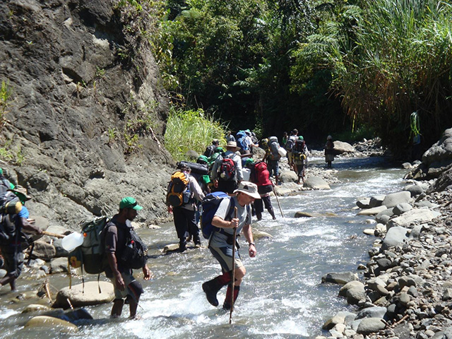
Today's walking is mostly level ground, with a number of river and creek crossings. Dry feet and dry boots are not always possible on this section. An optional detour on this sector is to explore the vicinity of Kankiryo and Crater Hill. Both of these locations were scenes of bitter fighting where relics remain. Further on from these locations, a deteriorating monument to Japanese engineering endeavor will be met for the first time. This is a vehicle road, constructed with great skill and greater effort, from the coast to within a few kilometres of the foot of Shaggy Ridge. To see it is to believe it ! Land slips and the collapse of bridging and culverts, plus the ever eager jungle vegetation have all taken their toll, but enough remains to be marveled at! We will cross this road from time to time, and, occasionally, be able to use the road form as a track with some clearing ahead by the carriers. Dependent on the rainfall of the time - and we are travelling in the loosely recognised "dryer season" of the area - will be the level of difficulty (and time required) for the river crossings. From here on we are very vulnerable to excesses of rainfall as we follow the Mindjim River system to the coast.
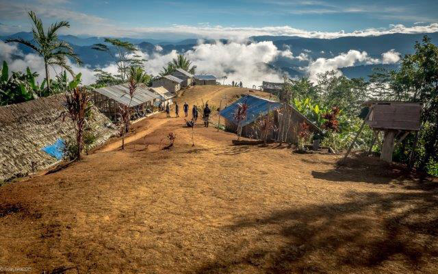
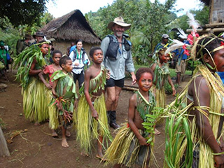
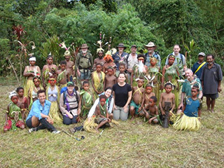
Arriving for Morning tea at a beautiful village called Paipa, friendly locals that want to share their stories. PNG Trekking Adventures has expanded local opportunities by encouraging cultural insights to their day to day lives. Sing Sings, Night walking, pig hunting, basket weaving, night fishing, school dramas, kids singing, local guided tours of interest, farming, Bui sampling, house building, roof thatching, local cooking can all be experienced within this village. This village is raw, remote and untouched by the modern world, they are extremely proud to show you their way of life. We will buy any available fruit and vegetables to supplement our evening meal. The village is a peaceful place, with a lifestyle as followed by generations. There is plentiful water in an adjacent river for washing and relaxing. Trek Distance 16km, 6 hours walking. (River shoes required), moderate flowing river. Bush Camp (Meals: BLD)
Day 6: Saipa Village to Alibu, Mindjim River High Ground Camp Site
We depart Saipa and commence the morning with a 2½ hour ascent followed by a descent through even more remote localities. The track we follow connects through to the war time route which has not been used by local folk for a great many years, we will be navigating our way from time to time through close jungle. The carriers and staff will be working on your behalf to simplify matters where ever possible! Lunch will be in Yokopi Village. We can expect to rejoin the Old Japanese Road after lunch, with some path clearing, following the road to the banks of the Mindjim River. Here we will follow the river along (and in!) by wading in sections and bank walking for others, until we arrive at our overnight camp on the river bank. The site is sandy, clean and quite comfortable in comparison to our earlier deep jungle camps. Water again is plentiful. Trek Distance 22km, 7½ hours walking. Camp will be on high ground along side Mindjim River. Bush Camp (Meals: BLD)
Day 7: Alibu, Mindjim River High Ground Camp Site to Gambul Village
We begin the day following the river. Soon after our start we enter spectacular gorges and ravines as we follow the river's course. The sides are steep with some rock ledges allowing passage, but these require many crossovers from one side to the other and back again, to achieve our forward progress. Wet boots are the main burden of the day. The scenery and settings are a good compensation. The first signs of closer settlements become apparent as we see dams across sections of the river's channels. They are made of natural materials placed to create attractive deeper pools for small fish to gather. The village folk use scoop nets woven from local cane to flick the fish out of the ponds for cooking and eating. Other interesting sights include sago washing locations where excess starch from the sago palm's product is washed out with much labour, using bark troughs and stream water, plus natural material shelters for hunters and gatherers staying out overnight from their village homes. As with so much you will see of the elementary "as was" life style of the local folk out here, away from more settled areas, you will appreciate the hard work to gather enough to keep a family in food and necessaries. As we progress along the river more signs of local people will be evident, with the larger village of Mabeluk (lunch stop) being the indication we have finished with bank and river walking for the day. From Mabeluk there is a clearly defined walking track which is level and away from the immediate banks of the river; although following the general line of the Imjim River.
Several small villages are passed until we arrive at the Gambul Community School locality. The first (or last! school along this track). Our night's rest will be here, adjacent to the school area. Again, you can expect to be of great interest to the people of the area. The river is close by. Trek Distance 21km, 8 hours walking. Camp on the outskirts of the village. River to wash is 7 minutes walk. Bush Camp (Meals: BLD)
Day 8: Gambul, Bogadjim to Madang
This morning we start after breakfast along the walking track near the river's edge. It is level walking for the main part. Occasionally the path arrives at the rocky banks of the river and a section of the journey requires "rock hopping" from one larger stone to the next. Then the path returns and the pace can resume to a comfortable walk. This is a major foot thoroughfare for local people, and no doubt we will pass, and be passed by locals carrying produce to market, or returning with purchases from the major regional centre of Madang. There are numerous villages along our path today, and still, trekkers are a novelty, so expect to receive helloes, handshakes, questions and inquisitive courtesies. There are a number of river crossings during the day - wet feet and boots again! The sun can be very unforgiving along this section of the expedition, so pace and exposure are monitored. "Good" water on the last half of the day's walk is not available, so we "load up" at a safe point with sufficient to see us through.
One last river crossing and suddenly you are on a two wheel vehicle track, which soon improves to a gravel vehicle road, with an occasional wash away limiting access until the locals decide to affect repairs. We would expect to walk the last 5 kilometers from the river crossing to the Bogadijm School. This locality was a major Japanese war base and the terminus of the Japanese Road we follow in part back in the Finisterre Mountain Ranges. It was also a German regional administration centre in colonial times around the turn of the Twentieth Century. Little remains to show for those times of importance. Our vehicle pick up point is the school. Photographs and congratulations precede the jump onto the trucks, and the road ride to Madang. Trek Distance 12 km. 5 hours walking. 1 hour drive to Madang. Accommodation Hotel. (Meals: BL)
Day 9: Airport Transfer
Today the group will be transferred to Madang Domestic airport to connect with flight to Port Moresby for their onward journey home.
For more information
Contact:
Dive Discovery
@
1 800 886-7321
(415) 444-5100
or
Request Info